Outline
- Smart Cities, Safe Roads and the New Digital Priority
- Data-Driven Insights are a Game Changer for Road Safety
- Continue Your Smart Transformation and Improve Road Safety thanks to Driving Data
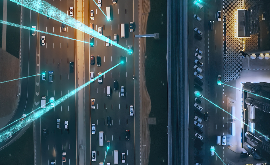
Outside the window, there are cars, roads, some pedestrians, and maybe bikes, a bus or a subway entrance. Also present, and connecting all these things and people together on the road, is data. Cameras, sensors, personal devices, onboard GPS units, all are generating driving data that is crucial to planning road infrastructure, improving road infrastructure, and ensuring safe transportation, fluid mobility and preventive maintenance. Driving data has great potential to improve road safety. The insights it provides are a crucial ally in having a tangible impact on road safety.
Smart Cities, Safe Roads and the New Digital Priority
Ready or not, the digital transformation has already begun in cities. Innovation is happening everywhere, and smart cities already exist. What is the cornerstone of a smart city? Data. Driving data and its insights are out there, waiting to be applied to improve urban infrastructure and road safety. In fact, the list of options for what is possible with driving data, when leveraged through a relevant analysis model, brings real added value in terms of decision and action.Improve Road Infrastructure
- Reduce road fatalities and road accidents: Driving data insights can help by identifying near misses and risky road zones, including in a multimodal context, where urban infrastructure comes into play.
- Monitor road infrastructure health: Assess the condition of roads, bridges and overpasses and plan infrastructure maintenance at the right time.
- Plan and build road infrastructure: Traffic and commute patterns can indicate where and what to build, including adding transit routes that reflect these patterns.
Develop New Mobility Services for Constituents
- Parking can become simple: It is estimated that 30% of congested downtown traffic is due to searching for a space*. Sensors installed on curbside parking spots could send availability data to a server, which would then send it to an application. The driver reserves and pays online, and arrives at their empty and waiting space.
- Welcome new types of vehicles: With data, you can develop a corresponding number of charging stations, locations, and even charging lanes for e-vehicles as their number grows. For autonomous vehicles that are beginning to appear, wider road markings on their routes can help them navigate more safely.
- Create a mobility-as-a-service platform: It’s possible to go further still with data. Mobility-as-a-service helps to dissuade people from using their personal cars. Instead, they choose multimodal forms of transportation, all reserved and paid for on one app, including the first and last miles.
Major Road Infrastructure Improvements are an Achievable Target for a Smart City
Part of the difficulty in transitioning to a truly smart city lies in modernizing assets. This involves installing the sensors, cameras, WiFi and other connections necessary to capture and transfer the data. All this hardware and innovation takes time to develop and is costly. There are, however, existing and ready-to-use intelligent driving data solutions with no additional road infrastructure investment required. They provide immediate and actionable insights that address one critical objective: road safety. *Donald Shoup, The High Cost of Free Parking, Journal of Planning Education and Research 17:3-20, Jan 1997Data-Driven Insights are a Game Changer for Road Safety
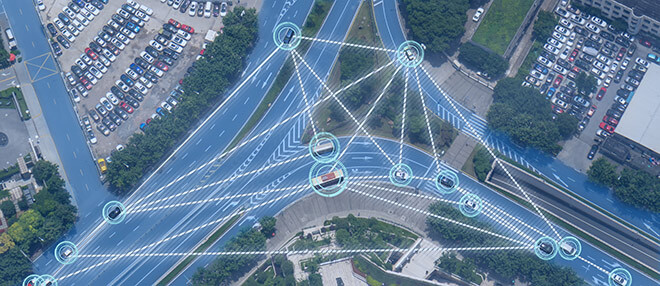
Raw driving data on its own is no more than billions of individual data points. Aggregating and contextualizing that data throws new light on a road network, highlighting driver behavior so that concrete actions can be made to have a real impact on road safety.Aggregated Driving Data
Aggregating and contextualizing driving data moves from individual data points to showing areas where driving behavior congregates, starts or stops. This type of information can be especially useful when sustainability objectives or multimodal travel must be considered. If, for example, driving data shows that a particular corridor sees a regular and significant increase in traffic, resources can be effectively allocated to study implementing a new public transportation offer.Data-Driven Road Infrastructure Insights
Analyzing aggregated and contextualized driving data can go a step further and provide insights into typical and atypical collective behavior. This makes it possible to detect near misses and identify risky road zones throughout the entire road network. With this knowledge, a preventive approach is possible, taking action before accidents occur. Road infrastructure can be adjusted knowing that it will have an immediate and positive effect on driver behavior, and therefore save lives.Requirements for Road Infrastructure Insights
This type of intelligent driving data solution is part of an ecosystem approach. To benefit fully from driving data and the insights it provides, public-private partnerships help by outsourcing the digital expertise needed. That way professionals on both sides of the relationship leverage their own expertise and resources in the most efficient way for all. Road safety solutions are created that serve the community and that stay up to date with technical advances.Continue Your Smart Transformation and Improve Road Safety thanks to Driving Data
Let’s look at an example. Say there’s an intersection where cars, trams, bikes, electric scooters, and pedestrians all cross paths. The trams have been given priority at the intersection, and there is a long wait as they crisscross in all directions while everyone else is stopped. After one month of trying the new priority, the road expert consults the aggregated and contextualized driving behavior insights that have been integrated into their GIS.
An Increase in Near Misses
Before the trams had priority, vehicles moved smoothly through the intersection. With the new priority, there is a change in driving behavior: a much higher rate of atypical behavior, specifically harsh braking, acceleration at the intersection and phone handling. This leads to a dramatic increase in near misses at the intersection, leading to a potential risk of a road accident occurring.Protecting Pedestrians and Cyclists
Upon visiting the intersection and studying the trouble spot, the road expert sees that drivers tend to pick up their phones while waiting for the trams to cross. When their light turns green, they’re still on their phone. Entering the intersection, their driving is distracted. As for pedestrians and cyclists, they don’t always wait for their signals. When drivers get their light, still on their phone, they are not fully aware of where pedestrians and cyclists are, causing near misses as they brake or accelerate to avoid them.Immediate Action Taken: Introducing New Road Safety Measures
After analyzing the insight of atypical behavior leading to more near misses, and the distracted driving at the intersection, the road expert acts quickly and efficiently. It’s decided to introduce both visual and sound cues to help all road users. Flashing lights and a countdown inform all road users of the time required for the trams to pass. A sound cue signals when cyclists and pedestrians can cross. And the dedicated bike lane is indicated with a new sign at eye level as well as road markings showing bikes they need to veer right. The impact of these changes can then be monitored over time to see if there is a decrease in near misses.Target Road Infrastructure to make a Tangible Impact on a Smart City
As demonstrated, aggregated and contextualized driving behavior data can provide actionable insights about how infrastructure is used and perceived. Drivers behave and react according to the environment around them. If many or all drivers react in an atypical way, it may be the road infrastructure that is the cause. Working with the right partner and the right model leads to effectively allocating and prioritizing resources. The right road safety measures that are critical to ensuring safer mobility for all road users at all times are adopted.