The safer roads suite:
Tailored to your needs!
9 services able to directly integrate into your geographic information system (GIS) with an exhaustive coverage of your area with no infrastructures required (no sensors, cameras, etc. to install).
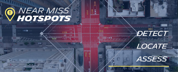
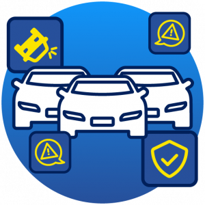
Locate hotspots of near misses accidents that happened on your road network, ranked in terms of potential risks with a powerful proprietary indicator.
Hotspots identified are correlated to past crash data thanks to artificial intelligence.
By using this service, you access millions of US connected drivers data combined with a powerful machine learning algorithm that computes 5 main atypical driving events: Harsh Braking, Harsh Acceleration, Phone Handling, Suspected Collision, Excessive Speeding.
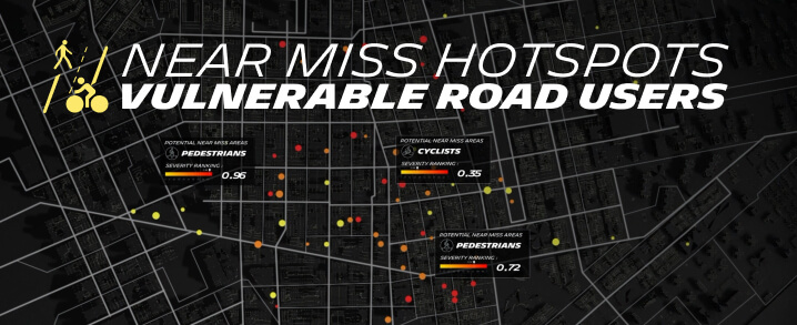
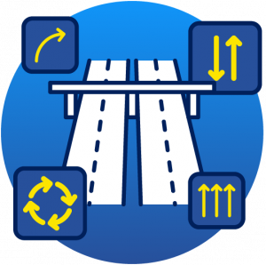
Go proactive by analyzing and understanding driver’s behavior at and around zones of encounter with Vulnerable Road Users to act before road accidents happen. This service is correlated with crash data and contextual data involving Vulnerable road users. It identifies patterns and detect the potential presence in risky areas of pedestrians and cyclists.

Lorem ipsum dolor sit amet, consectetur adipiscing elit. Fermentum, donec velit praesent proin facilisi nisl, feugiat ultrices. Viverra donec nibh in vulputate velit dictum sit vulputate. Euismod nunc, donec donec risus elit ante facilisis. Turpis ipsum ipsum metus turpis. Felis aliquam non, scelerisque quam cras leo cras neque. Volutpat ac imperdiet mattis ut augue. Curabitur pellentesque arcu quis arcu. Viverra donec euismod pharetra ac dictum hendrerit.

Lorem ipsum dolor sit amet, consectetur adipiscing elit. Fermentum, donec velit praesent proin facilisi nisl, feugiat ultrices. Viverra donec nibh in vulputate velit dictum sit vulputate. Euismod nunc, donec donec risus elit ante facilisis. Turpis ipsum ipsum metus turpis. Felis aliquam non, scelerisque quam cras leo cras neque. Volutpat ac imperdiet mattis ut augue. Curabitur pellentesque arcu quis arcu. Viverra donec euismod pharetra ac dictum hendrerit.

Lorem ipsum dolor sit amet, consectetur adipiscing elit. Fermentum, donec velit praesent proin facilisi nisl, feugiat ultrices. Viverra donec nibh in vulputate velit dictum sit vulputate. Euismod nunc, donec donec risus elit ante facilisis. Turpis ipsum ipsum metus turpis. Felis aliquam non, scelerisque quam cras leo cras neque. Volutpat ac imperdiet mattis ut augue. Curabitur pellentesque arcu quis arcu. Viverra donec euismod pharetra ac dictum hendrerit.
Locate hotspots of near misses accidents that happened on your road network, ranked in terms of potential risks with a powerful proprietary indicator.
Hotspots identified are correlated to past crash data thanks to artificial intelligence.
By using this service, you access millions of US connected drivers data combined with a powerful machine learning algorithm that computes 5 main atypical driving events: Harsh Braking, Harsh Acceleration, Phone Handling, Suspected Collision, Excessive Speeding.
Go proactive by analyzing and understanding driver’s behavior at and around zones of encounter with Vulnerable Road Users to act before road accidents happen. This service is correlated with crash data and contextual data involving Vulnerable road users. It identifies patterns and detect the potential presence in risky areas of pedestrians and cyclists.
Lorem ipsum dolor sit amet, consectetur adipiscing elit. Fermentum, donec velit praesent proin facilisi nisl, feugiat ultrices. Viverra donec nibh in vulputate velit dictum sit vulputate. Euismod nunc, donec donec risus elit ante facilisis. Turpis ipsum ipsum metus turpis. Felis aliquam non, scelerisque quam cras leo cras neque. Volutpat ac imperdiet mattis ut augue. Curabitur pellentesque arcu quis arcu. Viverra donec euismod pharetra ac dictum hendrerit.
Lorem ipsum dolor sit amet, consectetur adipiscing elit. Fermentum, donec velit praesent proin facilisi nisl, feugiat ultrices. Viverra donec nibh in vulputate velit dictum sit vulputate. Euismod nunc, donec donec risus elit ante facilisis. Turpis ipsum ipsum metus turpis. Felis aliquam non, scelerisque quam cras leo cras neque. Volutpat ac imperdiet mattis ut augue. Curabitur pellentesque arcu quis arcu. Viverra donec euismod pharetra ac dictum hendrerit.
Lorem ipsum dolor sit amet, consectetur adipiscing elit. Fermentum, donec velit praesent proin facilisi nisl, feugiat ultrices. Viverra donec nibh in vulputate velit dictum sit vulputate. Euismod nunc, donec donec risus elit ante facilisis. Turpis ipsum ipsum metus turpis. Felis aliquam non, scelerisque quam cras leo cras neque. Volutpat ac imperdiet mattis ut augue. Curabitur pellentesque arcu quis arcu. Viverra donec euismod pharetra ac dictum hendrerit.
Why use our service?
BETTER RESOURCES ALLOCATION
Better allocate and justify resourcs and project funds thanks to fact-based KPIs.
FACT BASED MEASURES
EASILY INTEGRATED TO YOUR SYSTEM
MICHELIN DDi's data is compatible with any GIS. It allows you to digitally steer fact-based measures throughout the year with continuous data capture and with no hardware required.
BEFORE/AFTER ANALYSIS
Monitor and highlight your actions through better/after analysis.
Actionable insights,
to empower your preventive
road safety plans
As the number of traffic accidents remains too high, we believe, more than ever, that it is time for technology and data to serve drivers and improve their safety.
At Michelin DDI, we combine our expertise in data analysis and driving behavior to create solutions that contribute to safer mobility.