Outline
- Speeding and its Road Safety Dangers
- Current Speeding Detection Methods
- Current Speeding Detection Methods Tell only Part of the Story
- Complementing Fixed-Location Speeding Detection with Driver Behavior Data
- MICHELIN DDi’s Expertise in Speeding Detection
Speeding was a factor in an estimated 29% of traffic deaths in 2020. 11,258 people lost their lives – an average of almost 31 people per day – due to this risky driving behavior, considered aggressive by the NHTSA. And speeding is on the rise. 2020’s death toll is 17% higher than 2019’s (compared to a 10.5% overall increase in road fatalities). Current speeding detection techniques are unable to thoroughly assess an entire road network, as they are tethered to specific locations. New technology can detect, identify and locate this driving behavior, and more generally Near Miss hotspots, on all roads in a transportation system. DOTs can pinpoint hitherto unknown problem areas and determine proactive road safety measures – that will save lives.
Speeding and its Road Safety Dangers
Speeding refers to driving too fast compared to the posted speed limit. Even when driving at the speed limit, it may be inappropriate for certain driving conditions, including bad weather, road works, poor visibility, nighttime, etc. The main reasons for speeding range from “running late”, to road congestion that leads to more risky driving behavior that includes speeding, to a mindset that chooses to challenge the speed limit.
When dealing with speeding, context and frequency – sometimes, always, never – must be considered. Far from a trivial driving behavior, there are consequences for the driver and their surroundings, and the environment, which is not usually associated with speeding.
Speeding and safety
After noticing danger, a driver who is speeding requires a longer stopping distance. There is also a greater potential for loss of vehicle control. The IIHS explains how speed can affect vehicle control in terms of the exponential increase in energy that needs to be managed:
“For example, when impact speed increases from 40 to 60 mph (a 50 percent increase), the energy that needs to managed increases by 125 percent.”
Source: https://www.iihs.org/topics/speed#dangers-of-speed
This increase in energy leads to protective equipment being less effective, both inside and outside the vehicle. Crash severity becomes greater, leading to more serious injuries. The cost to society is therefore also more substantial. In a 2015 report, the NHTSA estimated the economic impact of driving too fast for conditions at $52 billion (costs include emergency room visits, health care charges related to the hospital, rehabilitation, and doctor visits, and property damage).
Source: crashstats.nhtsa.dot.gov/Api/Public/ViewPublication/812013.pdf
Chances of Serious Injury or Death at Different Speeds :
| Speed | Severe injury | Death |
| 16 mph | 10% | – |
| 23 mph | 25% | 10% |
| 31 mph | 50% | 25% |
| 39 mph | 75% | 50% (42 mph) |
| 46 mph | 90% | 75% (50 mph) 90% (58 mph) |
Speeding and the Environment
As for the environment, speeding generates higher greenhouse gas emissions and pollution:
- Increased fuel consumption during acceleration and driving
- Increased use of brakes to stop
- Potentially increased idle time as drivers wait longer at lights.
The more even and calm driving is, the lower overall emissions are and more fuel is saved.
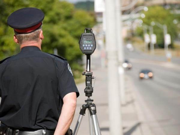
Current Speeding Detection Methods
To control speeding and avoid its repercussions, a number of speeding detection methods exist.
Radar
The main method of detecting speeding in the United States, radar technology is known for its precision and reliability. Radio waves are emitted from a handheld radar gun or speed camera. The frequency at which radio waves are emitted changes as they bounce off a vehicle – like the change in a siren’s pitch as it approaches and passes. This change is used to calculate a vehicle’s speed. Offending drivers can nonetheless be harder to catch in heavy traffic, and some use radar detectors to avoid being caught.
Laser
Using LiDAR light detection and ranging, laser technology calculates speed similar to a radar, using infrared laser light instead of radio waves. LiDAR can be even more accurate than radar when identifying cars in heavy traffic, since the cone of light is smaller than sound waves. An officer can target a specific vehicle.
VASCAR
With Visual Average Speed Calculators and Recorders, a driver’s average speed is calculated between two reference points, giving a fuller picture of their actual driving behavior. When a car crosses the first, an officer starts a timer and stops it when the second reference point is crossed. A computer calculates the average speed. A very dependable method of identifying speed, a patrol car nearby is required to run the measurements.
Aerial Speed Measurement
This costly technique combines people in a light aircraft with ground crews. Those in the aircraft measure the time it takes a vehicle to travel between two pavement markings that are a known distance apart. The ground crew uses the ensuing speed calculation to issue speeding tickets as necessary.
Speed Cameras
Mobile cameras use radar, and fixed cameras use radar or detectors embedded in the road’s surface, to measure how fast a vehicle is going. When speeding is detected, the date, time and location are recorded with a photo of the vehicle. Two cameras can also be placed a certain distance apart to measure average speed.
Current Speeding Detection Methods Tell only Part of the Story
While each of these techniques is able to identify speeding on the road, they are not ideal. All detect speed only at fixed locations. All tend to be placed at locations where this driving behavior is already known to exist. All, apart from speed cameras, require the presence of a person to work the equipment. None are able to detect near-crashes.
Complementing Fixed-Location Speeding Detection with Driver Behavior Data
To address the problem of speeding, driving behavior can be detected and analyzed. All roads throughout a transportation system, beyond main arterials, can be monitored for speeding and near-miss incidents, in a wide variety of road conditions and contexts. Understanding the conditions that give rise to speeding behavior, and pinpointing the risky locations, help to prioritize and adopt appropriate safety measures – such as introducing a speed detection technique where previously there was none.
Speeding and Road Surface as Factors in Fatal Crashes (2020)
19% of drivers on dry roads
21% on wet roads
33% on roads with snow and slush
42% on roads with mud, dirt, gravel
42% on roads with ice, frost
45% on roads with moving or standing water
Source: https://injuryfacts.nsc.org/motor-vehicle/motor-vehicle-safety-issues/speeding/
MICHELIN DDi’s Expertise in Speeding Detection
MICHELIN DDi, Your Partner for Proactive Road Safety
Combining our expertise in data analysis and driving behavior, we create solutions that help you detect, locate and assess where road safety issues are happening for all road users in your transportation system.
Our driving data collects events, such as excessive speeding. A driving event is when there is a sudden or atypical change in driving behavior. Other types include harsh braking or acceleration. We then aggregate and contextualize driving events, to include time of day, day of week, weather conditions, type of road…
Speeding is also taken into account in our proprietary statistical and machine learning models created to identify Near-miss hotspots.
Choose from our suite of services, which can be tailored to your needs:
- Count and get detailed information on how often speeding and other driving events happen
- Assess and rank by potential severity Near Miss hotspots
- Leverage our crash probability indicator based on our unique machine learning model
The data you receive is compatible with GIS systems, and reads like a heat map. You can easily identify where speeding and near-crashes regularly occur and under what conditions, and introduce corrective measures to improve road safety preventively.